February 11 - 17, 2002
when it snows in Sierra Nevada and you ride out into a frozen desert, don't trust you maps, and don't forget replacement batteries.
| Following tracks of the Lost Burro (1/2) February 11 - 17, 2002 when it snows in Sierra Nevada and you ride out into a frozen desert, don't trust you maps, and don't forget replacement batteries. |
Last year we almost missed our President's Day (national holiday); this year, being a member of the working class with no accrued vacation time, I was eyeing this day off since Christmas. We simply had to go to a trip -- end of discussion.
 |
||
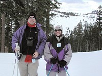
| Don't get scared - monsters have a field day today |
We originally flirted with an idea to go to Joshua Tree, but thanks to my illness I got hit with ski and snow withdrawal syndrome. Result was a compromise -- one day skiing, THEN on to the desert, though not at Joshua Tree, where the whole Los Angeles would move to again just like on Thanksgiving.
Easy said, easy done -- on Saturday morning we woke up (WITH NO EXTERNAL HELP!!!) at six, ate breakfast, jumped into our Wagon and started among trees in a full bloom towards Kirkwood. We swore not to try to eat again on the way, for greasy toasts with yet greasier scrambled eggs and fried sausage are never worth the wait. We only stopped once for a sandwich at a questionable deli, where a miss behind the counter took her sweet time to slap together some bread, ham, and cheese, as if it were three course formal dinner. On the other hand, everything was fresh and just like we wanted it. We were panicking, however, for a completely different reason: the only road to Kirkwood (highway 88) was deserted -- no roaring SUVs stuffed to the top and over the top with eager skiers; no slithering sliding executives who put aside their suits and glide along in their sparkling, gold-rimmed lexi across icy mudpools, direction wilderness. We troubled our minds with various catastrophic plots like "snow has all melted" or "real war broke out" -- as most probable, we agreed on "everybody's already there", for this weekend marked the beginning of spring holidays for most kids.
 |
||
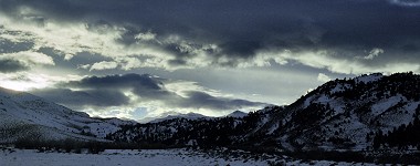
| The sun is setting over (closed) turnoff to Sonora Pass |
Non of the above was true - Kirkwood was half empty and according to claims a driver of the ski shuttle made, it was because of a) bad weather forecast (wind, snow, rain) and b) those, who had holidays, would arrive on Sunday; those who don't have holidays did not come to avoid family crowds. Still, we had to park at the outermost lift Hole 'N' Wall, but as it is just a kiddie slope, we took the shuttle all the way to Solitude. We skied it down on a very fast, re-frosted snow, and Sid had an idea to cross to the "back side". We traversed the slope to The Reut and from the top of it, we took a kind of adventurous, forest trail to Caples Crest. It took us to a ridge and we could choose to ski back, or take the back side. We opted to go on and discovered another lift to yet another ridge. What was amazing was the emptiness of the slope there (almost no people at all), and we decided to traverse to it on our next round.
On Sunrise we felt the first time that there ain't no jokin' with the weathermen - wind was blowing heavily across the ridges of Sierra Nevada, several last yards of the lift ride were almost unbearable, despite educational signs on lift pylons, which tried to entertain us with a story about an old trail where ancient ox teams and pioneers fought through the pristine wilderness westwards to gold-bearing rivers of Eldorado. On the top, wind swept our briskly across a polished icy plain behind the ridge -- and it was quiet again. There were two wide groomed slopes available, but you can ski in an area over a mile wide. And so were we, sliding down among pines and firs, with the only sound being that of our skis breaking through virgin surface. It reminded me of skialpinism, and Sid, immersed down to his knees in deep powder, yelled that we gotta take a picture of this. Then he added that he was hungry -- there was no other way than to return back to our car.
 |
||
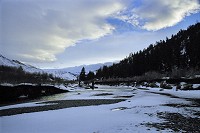
| Daylight is slowly fading over Walker River at highway 395 (compare to a peaceful autumn) |
I will spare you a litany of lifts and slopes, but it meant riding up and skiing down another four, and then marching a bit. At our Wagon, I ate the rest of my sandwich, while Sid was watching me sadly, for he swallowed his whole meal already in the morning. He had to contend with an unfriendly piece of tired pizza at a lodge. I think that next time, we will have the slow, careful miss make us sandwiches for lunch as well, thus snubbing any temptations of cafeteria nourishment. We collected our camera and embarked on a six-lift traverse back. Alas, in the middle of our hopping, our luck ran out -- lifts stopped -- gee -- it was four thirty and visibility got bad (I don't mean that darkness would fall, but the moment when snow begins to fade into a continuous, featureless background). We boarded a tram for our Wagon, and took of in the direction of Bridgeport, California, where our reserved motel room beckoned.
 |
||
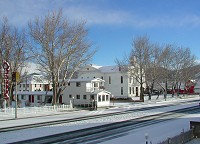
| A desert town of Bridgeport unwraps from white Sunday dawn comforter |
My Hippo, mightily unhappy with an early afternoon and very miserable pizza, grumbled that he would eat something,
and what about the Mountain View BBQ at Walker. I have already mentioned this establishment
once, so there's only one thing to be added,
and that is a fact that a home made sauce tastes even better after a frosty day of skiing, than during a mild
winter day. We admired again various car registration plates hung over walls of the restaurant -- I was most
intrigued by a Nevada plate of PIMP.
Sid, on the other hand, claimed that since prostitution is legal in Nevada, there's nothing wrong about a
proud entrepreneur displaying his calling on a car. After all, he was not ashamed either of being a Hippo
(our car carries HROCH plates on both ends =
Czech word for HIPPO).
The most curious one was a Romanian plate -- American Ambassador to Romania ate once at Mountain View BBQ and
was so satisfied that he promised to send back a plate of his armored vehicle in Bucharest -- I would be quite
interested to know what the Romanian traffic cops had to say about that...

 |
||
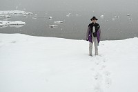
| Usual tens of miles of visibility across the Mono Lake Basin are not happening today |
Motel owner at Ruby Inn, Bridgeport, knew right away who we were (could it be that we were the only ones who reserved their room over the internet?). He assured us that it was the last room he had, and answered our puzzled (Bridgeport is during the winter cut off from populous places by an impenetrable barrier of Sierra Nevada) question: all rooms were rented to skiers -- Kirkwood was only two hours away, and so were Mammoth Lakes to the south. He also informed us that regardless of whether we like to smoke or not, all rooms are non-smoking and always were, even back in the times when public smoking was legal in California. He said he was allergic to it and that smokers smell very bad; and when girls cleaned up a room after a smoker, it took them so long that the whole rent went into their pay, which he as the owner could not afford. We confirmed smokers to be the vermin of the humanity and hurried to our cozy, good smelling, and really exquisitely clean room.
 |
||
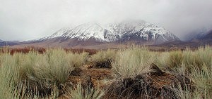
| A little higher, snow holds even in a desert at Owens Valley near Bishop, CA |
In next five seconds I broke a record in disrobing down to my underwear -- no, no, it was not an explosion of spousal amorous emotions, but an outdoor hot tub became available. Sitting immersed to our necks in a hot water, we almost purred with delight, how our tired muscles relaxed. This motel belongs to the more expensive ones, but I think that we got what we paid for, and what we had deserved. Besides a hot tub and a clean room, we also enjoyed a quiet night -- no fans or heaters rattling behind a cardboard partition, no SUVs warming up at 5 a.m., to rev up for some fishing adventures...
Another romantic surprise awaited us in the morning -- overnight, all the promised "bad weather" finally arrived into the desert, and it snowed about half a foot, and sun got out again. Sadly, during our breakfast at Hays Street Cafe, dark clouds took over again, and a full snowstorm caught up with us at Mono Lake. It lasted beyond Mammoth Lake, where we observed streams of disappointed skiers leaving south. Fog, wind, snow... nothing much. An so we, too, rolled on southwards and down, descending to Bishop, where we suddenly crossed the snow line and found ourselves in a "common" brown-green desert, the way we know it.
 |
||
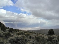
| Panamint Valley (Death Valley National Monument) is getting either a load of snow, or a load of dust. |
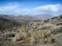
At Lone Pine we eyeballed the chances of precipitation in the desert (negligible), fired up our GPS, and headed for Racetrack. On a road, for a while, then off. After I spent an hour zigzagging on a horrible road (a beat-up, old asphalt path with potholes the size of a wash basin), I dared to ask my navigator how longer it would take. He said, forty two miles. On a second gear, going between ten and twenty miles an hour, it felt damned far, but I kept on driving some more -- the road turned into narrow, muddy tracks lightly covered with snow, so it was not clear, which slushy hole was deepest. Eventually I ran out of nerves -- my hands got all shaky and cold sweat streamed down my back. Although I love dirt road driving, after so much of it, in a soulless desert filled only with wheezing wind, I was at my end. Sid took over at Hunter Mountain making fun that I covered the worst parts -- our track became a well bulldozed dirt road. His luck did not last long -- avoiding a jeep in a mountain switchback with a loose shoulder belongs to those less pleasant memories. The really worst part was still ahead of us -- on one junction, our GPS sent us right, allegedly around Quackenbush mine (marking the other alternative as a less traveled road) -- and then it blanked out. It is understood that we ALWAYS carry spare batteries for both the GPS and the camera (same kind), but you can guess, how many spares we had with us this time, now that we really needed them... We had to rip batteries out of my camera.
 |
||
| Hunter Mountain: fifty miles off the road from any frequented highway |
After restarting our gadgets we found that we were on a dead end (though obviously driven on -- there must have been others who got caught this way) going to an abandoned mine, and we could either drive back for miles and miles to the original junction, or try to break our way through an ancient track (with our computer map insisting this was the main road), around Quackenbush. Sid, as a pilot, opted for Quackenbush and revved the Wagon up into a steep hill. Rocks and deep driven tracks, rimmed by high hedges with resilient desert bushes, did not strike me as a suitable path for even for our "all wheel drive" with a relatively high clearance. Grinding sound of teeth in my mouth mixed with the sound of bushes scraping the sides of our car, knocks of boulders hitting our undercarriage, and Sid mumbling apocalyptic outlooks, our wagon somehow crawled all the way to a sign "DANGER" with a merry writing on how these old mining tunnels can collapse under you. Standing on a hill, we cursed the authors of our map, and concluded that last time anyone tried to use this track, it had to be the owner of the mine on a mule, leaving his worthless claim, finally cured of his Gold Rush. Our cursing and spinning of theories did not change the fact that we found ourselves at a completely deserted spot, about fifty miles any way from civilization (that being highway 395 on one side, and a road across Death Valley on the other).
Amidst my mental catastrophic plots, I counted our inventory -- two FM radios (with nominal range of 2 miles, made for a ski slope rather than wilderness), sleeping bags, field mattresses, fuzzy blankets (it was horribly cold), about one and half gallon of water, eight cereal bars, two apple sauces, a bag of smarties, two sweet coffee drinks -- hmm... hmm... hmm... a day, maybe two, we could survive. Sid, in turn, looked out into the landscape, and suddenly said that there on the flat, which I could not see being short-sighted, our road improves considerably, and if not, there must be enough room to turn -- and drove forward.
Next time -- about a Lost Burro, what in the world is this Racetrack, and whether is was worth all this risky adventure; why I will not have cellulitis, about wheezy trains, clever engineers, Fig Orchard, and Kern River.
| Copyright © 2002-2005 by Carol & Sid Paral. All rights reserved. |