November 28, 2000
On Indian motels, Finicky Coyote, marinating, Dalí's exhibition, GPS in a desert rallye, but mostly about beautiful Death Valley and "soul bath" in Joshua Tree.
So we thought we would drive out on Friday after Thanksgiving (on our day off), right in the morning, but since the party at Kren's was rather demanding, we somehow lost track of the time and slid towards our typical three in the afternoon (by when we were not only packed, but we also had oil changed in our Wagon, travel supplies bought, and having had lunch at Tien Fu, here in the Valley).
We rolled through Pacheco Pass and down the Central Valley into the Tehachapi Pass, where we swallowed some sandwiches at a "historical" bar (yet, it could be there almost whole seventy years!!!). They had an interesting picture collection hanging on the walls. Airplanes, fighters and space shuttles in the main room (Mohave desert is a large place full of middles of nowhere, but it contains captivating locations, forbidden to behold for ordinary mortals, as the military is separated from civilization by miles and miles of deserted landscape), in the neighboring hall they were showing pictures of a railroad loop. When tracks were laid nearby, it was found that an engine would not be able to climb with the usual load into steep local hills, and so instead of digging a long tunnel, they had built a loop, where a train can go three hundred and sixty degrees around, while gaining needed elevation.
Ridgecrest was our place to go to sleep, at a motel run by an Indian (the Asian kind)
family. Wildly colorful tiles in our bathroom were included in the price, and so was a stripe
with oriental motif on each wall (not mentioning a breathtaking painting with mountains, which
only lacked a rutting elk)  .
I have never been to a cheap brothel, but I think it could look like that.
Unfortunately there was hot air heating with an unbelievably noisy fan. We opted for chill,
but not so our neighbor. I had a feeling I was trying to sleep next to a military runway,
with fighter jets taking off behind my head.
In the morning we started unusually early (before nine  ),
hence the only open establishment where they would supply me with my start-up coffee, was Carl's Jr.
(similar to McDonald's), but a nice service and hot coffee had dispersed black clouds of breached
principles.
 |
||
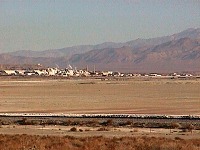
| Welcome to Trona... |
And so we drove into the forest. Mohave is my first real desert that I had found myself in. Empty, huge, and beautiful. It welcomed me with an awful stink. I almost decided to order inspection of all shoe soles, whether we stepped into something or not, when we slid across a hill and discovered little puffs of smoke in front of us. Trona.
Trona consists of a nightmare of a salt factory. A giant scaffolding of pipes, steel beams, ladders and transporters, crowned by smoking stacks and sulfuric smell. Scattered around the factory, you can find decrepit huts, abandoned motorhomes and trailers, and countless immobilized vehicles. And dust, sand and salt everywhere you look. People in Mohave can't have much choice. You either belong to the military, work in a mine -- or live off welfare. Some places get richer from tourists, but not much. Simply wasteland.
 |
||
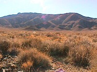
| Terry towel desert hills |
I don't want to give Trona a desperate description, on the upwind side of the town, we passed a several blocks of nice looking homes and a renovated school. Though, following that we were again driving though a mile of wrecking yards. I still recommend anybody a visit to Trona, it certainly is an interesting place, for one can discover there how well off one is.
There's no civilization past Trona, until the entrance to Death Valley. We stopped on another hill with a view to Panamint Valley (the one before you reach Death Valley), and there it happened: desert breathed at the back of my neck. Nobody around, no house, no fence, and complete silence. And only hills around, without a single tree. Suddenly one has no place to hide, and looks back instinctively, where did those forests go?
Still I got used to it in a little while, for there's always something to look at in the desert. Hills in Mohave are colorful, overgrown with thorny bushes, so they look like if they had a fitting hood made of dark brown terry cloth (hills closer to home look fuzzy, from grass growing on them).
 |
||
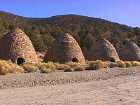
| Kilns at Wildrose Canyon |
We bravely chose a track through Wildrose Canyon, which is neither wide, nor maintained much (you can reach Death Valley over regular blacktop as well). Wildrose Canyon winds up under Telescope Peak (11,049 ft) and passes through a tree line. Sid suddenly stopped near strange looking rock buildings, which looked like huge beehives. I was to guess what they were, but my imagination could not cope with such oddity. They are charcoal kilns.
 |
||
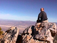
| Aguereberry Point, Death Valley in background. |
Since Sid never hiked up on Telescope Peak, we wanted to fix it. Road up is bad and ends way below the top, in a campground. Normal looking trees, pines mostly, grow at this altitude. Lower it's too hot, higher too cold. Trail up was promising seven more miles to go, which would mean spending the rest of the day there, and so we put it aside for later, since our main destination for that day was Death Valley.
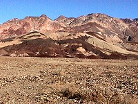
Past Emigrant Pass (yet, that's its real name, which seemed quite fitting to us), we led a relatively well driven dirt road lure us to take a detour. After about two miles, we discovered an abandoned mine. Still the road continued through a canyon between hills out of sight, so we took it. When we slowly began to consider turning on our GPS to see where we were going, a port-a-potty appeared in front of us. Well, that meant somebody was counting on tourists coming here!!! Momentarily, a great view opened before us, to a big part of Death Valley. Aguereberry Point (6,280 ft) must be avoided by real tourist crowds (thank God) only because of that bad road. Two Japanese guys who dithered around there, were about to leave anyway.
 |
||
| Death Valley - is it not beautiful??? |
We sat down on a rock and gazed down, fascinated. Our view was pretty colorful... and complete silence surrounded us. Complete one, not even a bird chirp. A thick gray line over the valley caught my attention, so I asked smartly, "Are we going to drive on that road?" Sid looked at me strangely and uttered: "Well, girl, your scale needs adjustin'." And it did. Desert has low air humidity and visibility can extend well over hundred miles. This "road" of mine is a large, salty, dry river bed. A regular road could not be seen at this distance (Sid claimed that he could see it, but he knew where to look), a small town formed a tiny green spot in background.
 |
||
| Sand dunes in Death Valley. |
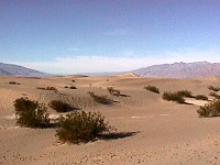
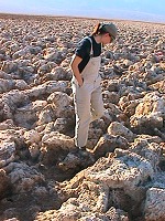
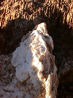
The name "Death Valley" has always inspired me to imagine desolate heaps of sand dunes, where no-one goes for it is unbearably hot there. It was hot, of course; now, in November it was some 80°F, temperatures in July reach over 120°F. The National Monument covers 3,340,410 acres, with highest point, Telescope Peak, reaching 11,049 ft, with a single drop-off going down to Badwater, 282 ft below sea level. You can find many interesting locations in the Monument. Sand dunes, several tens of feet high, can be found near Stovepipe Wells Village. Devil's Golf Course, next to Badwater, looks like an ordinary deep-plowed field, but it is all natural, made of salt formations, with hard and sharp edges; one is ill-advised to fall there. Some salt pillars are cracked, and you can see a white shiny cavity beset with salt crystals inside.
 |
 |
|||
| Devil's Golf Course | Crystals on the Course | |||
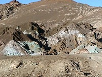
Sid promised me Artist Palette, which was, sadly, besieged by tourists, but it was worth seeing a place with so many small, differently colored rocks. Thanks to variable mineral content, you can find rocks of red, yellow, white, black, blue, green and purple. Kind of like in a opium dream. We missed sunset at Zabriskie Point, but my eyes were very tired by then. They burned me unpleasantly, perhaps due to combination of sunshine and dust. Fortunately we carry a cleaning solution for Sid's lenses, and thus I could irrigate my eyeballs.
 |
||
| Artist Palette |
We called for a war meeting and finally decided to transfer to Joshua Tree National Monument. Though it was rather very far to go, we had nothing else to do after the sun had set at five p.m., and we filled the time by crossing all those uninteresting places and getting where it was pretty again.
Sid started our GPS and I drove like a racing car driver. No, I was not really going fast, but Sid kept announcing all turns. GPS is a gadget that receives signals from satellites and determines, where it is. Not only geographical coordinates, but also altitude. It can also calculate speed with which you're moving. The military occasionally insert some error into the signal, but even with that the GPS won't err by more than a few yards. We pack a computer with detailed software maps, so instead of much fussing with large sheets and flashlight shining, we watch how an arrow, representing us, crawls over the screen. We played with it on our way to Twentynine Palms and did not have a clue, how much this training is about to pay off.
29 Palms (that's a real name) is a tiny town near Joshua Tree NM, and quite obviously survives only thanks to existence of a huge marine base. Yes, you are reading correctly. There IS a marine base in the middle of the desert.
 |
||
| Joshua Tree NM |
 |
||
| Rocks at Joshua |
We found lodging in a motel, (for a change) with an Indian owner. I am beginning to form a suspicion that all Indians buy their furnishings in the same supermarket. Here we missed a piece of art over our bed, but we were blessed with the same tiles in the bathroom, and noisy heating. Our shower cabinet, in addition, sported dark violet curtain with dark red POMPONS!
We immersed ourselves into the rush of the metropolis, to get down some dinner chow. We deliberated
at length, whether to get something Japanese, Indian, or Mexican, but to no avail.
In the whole town, we found only the following establishments open: one pizzeria, one video
rental store, one McDonald's, a tattoo saloon, and two barber shops that promised a true marine cut.
Out of desperation we drove towards the base, trying to find out if perhaps the military would
stimulate some dining business. It did not, only our neighborhood got more and more "marinated",
so we returned to the pathetic pizzeria. Spending a day in the desert made our throats dry and dusty,
so we washed it down with a pitcher of deer slop.
American beers are drinkable only in case you just came back from a wasteland, dried to the bone.
Then you don't mind that they have the color of a lemonade, and taste ... well, like elk piss.
 |
||
| Yucca is yuccing at us. |
 |
||
| Fuzzy Cactus |
There was a group of French people at a next table, whom I guessed to be rock climbers, but even after an hour they did not began to climb virtually (make wide gestures and indicate to each other how far that shallow bottom hold was that you'd put your right hand in...), well, I may have erred.
We did not even tried to search for a breakfast place in the morning, resigned to have a coffee and a sandwich at a grocery store. Yet the store was so terrible that we left and lo! -- Finicky Coyote appeared before us, a coffee shop crossbred with a pastry bakery -- another cute spot with its own character, pleasant service and great food.
Hence we drove, our spirits high, into the Joshua Tree National Monument. Sid pointed out that left to the road was an Indian (as in Native American) reservation. Well I don't know, it looked like everywhere else. Homes, cars, quite pretty cactus gardens (that's not an irony, normal flowers would not grow there and cacti are really beautiful).
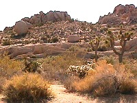
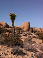
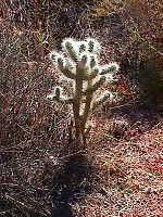
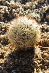
Joshua Tree got its name from a strange kind of yucca cactus, which grows here.
Yuccas develop branches at funny angles, and to some people they look like outspread arms.
Mormons, when they first came to the American West, this cactus tree reminded of biblical
Joshua (praying to God above), so they called it a Joshua Tree.
 |
 |
|||
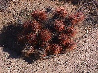
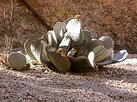
| Little red cactus... | ... and little green cactus. | |||
Joshua Tree National Monument is an awfully pleasant place to be. Yuccas are yuccing at you everywhere, waving their arms, huge variety of cacti grows all around you, while still politely leaving enough room to let a human pass through. I still recommend high, solid boots and thick jeans -- as soon as you stop keeping polite distance, you end up being a pincushion. Then you'll need, to the amusement of those nearby, to pull down your trousers and pull the thorns from your skin one by one -- most cacti have thorns the size of a larger needle, only much, much sharper.
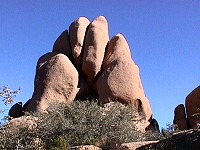
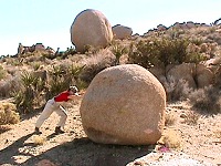
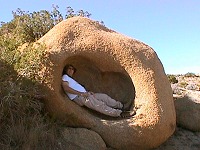
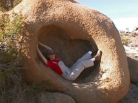
Besides cacti, Joshua Tree contains beautiful rocks. A learned book says that it is monozoit,
it looks like a coarse, structured granite. Monozoit is eroded into wonderful shapes, you feel like at an
exhibit of "Dalí and his croissant period". Inside this park, nobody will harass you
to walk "on marked paths only", but be aware! - croissant rocks and cacti look identical in all directions
and you can get lost in no time.
 |
 |
 |
||||
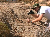
| Sid takes picture of... | ...a ball... | ... while all the work was left for me :-) | ||||
We wandered through the park, pointed out the most beautiful cacti, pulled thorns from our sides, climbed the rocks and felt like in a great garden.
Alas, it was Sunday and we had to get home the same day. We quickly drove up to Keys View, from where you can see Palm Springs, Salton Sea (a lake) and all the way to Mexico if you're lucky. We were.
In Barstow, we stopped for lunch at the Golden Dragon. The restaurant looks run down, but their Asian food is great -- a rare thing so deep inland. During our late lunch we overheard an announcement on the radio, highway fifteen stood still and was going to be for another hour or so due to a collision. We did not plan to take fifteen, so we did not care. We paid a waiter who claimed to remember Sid from last time (Sid ate here maybe three times over five years), and content, we drove out on highway fifty eight. A little way outside Barstow, we could see some smoke in the distance, looking like the desert was burning. And then we only saw an ocean of stop lights and we halted. Not knowing what was going on, because the smokey area was still far away, we inched closer and closer, and examined our map desperately -- we were trapped, as there was no other way than the 58 -- only going back some hundred miles or so and go around. When we approached the smoke, it turned out to be dust, whirled up by cars crossing the median, opposing lanes, and entering a dust track on the left side of the freeway. Traffic on the freeway was visibly stopped all the way to a far horizon. It was not difficult to decide which way we would take, despite the dust. Better than standing for hours and hours helplessly stuck in a traffic jam.
 |
 |
|||
| At the exhibition "Dalí in his croissant period"... | ... they offer you a sofa... | |||
Sid tuned up the GPS, I switch on our fog lights and we drove on. Some smart guy knew that there was a service road along some pipeline in the ground, and plowed on. Sid found us on our map, but he also discovered another road more or less parallel to ours, possibly with no cars and therefore with less dust. And it also did not re-enter the stalled freeway, but another highway crossing the fifty eight. We did not need to return to the freeway at all and we could continue on the crossing road, taking a detour over Lake Isabella.
We found the other road, but it was not as used, and did not look not very passable. We decided to try yet another one, some four miles farther.
I dared to go in third gear over this dirt road, so I went. Suddenly we hit something with a great bang. It was the time of day with some, but not much light, just after sunset, and our GPS did not warn us about an intersection with another well-bulldozed road. I did not se it, as bushes grow there about the size of our car, and yellow dust threw no shadows. Thus I burst through a traverse trench, across the road, and through the opposite bank. Sid yelled, as he bumped his head while trying to catch our computer and the GPS. I think I managed to say a prayer really fast several times, asking to not have torn anything important on the car. I was not intrigued by a vision that we march those few miles back to the freeway, then getting to a phone, and arranging for towing.
Fortunately nothing happened, and the road which we thus literally bumped into, was well maintained. It also went exactly where we needed to go. It was, again, a service road, this time for high voltage power line, which we had on our map.
I discovered that I enjoyed driving off the paved road; now I have to find out where I can rent a
tank. 
Having surfaced beautifully right at the intersection with fifty eight... jammed into the all the distance we could see, apparently only because this intersection had a low throughput traffic light! We still did not risk to get back on (though it would have been shorter), and we took a detour much less comfortable and much longer, but devoid of weekend traffic. Sid claimed that we were going through a beautiful country, and we possibly did, along Lake Isabella and across a corner of Sequoia National Forest, but that was several hours after dark. We decided to save it for next time.
When we finally finished crawling over county road onto interstate highway five, and drove about a mile on it... guess what? Right, another traffic jam!!! Sid pulled out our GPS again, and the computer, and at the nearest opportunity we left and rolled on through weird roads onto a parallel one-oh-one. These were roads literally "in the middle of nowhere", which turned out to be very nice. Traffic near Paso Robles grew thick again for a while, but it passed.
Then I was practically unable to keep on the road, and Sid had to drive the rest. Just this Sunday, we
made about 600 miles (like Prague to Italy), over the whole weekend, we collected 1,400 miles. Got home at
one a.m., completely stiff. But it was worth it.
| Copyright © 2000-2005 by Carol & Sid Paral. All rights reserved. |