
Montana precedes.
 |
ACROSS THE DIVIDE | |
| Hippo's
vacation: through the states of American Northwest, section MT-ID-WA-OR-CA. Montana precedes. |
... continued (from Montana).
 | ||
| Idaho surprise. | ||
 | ||
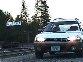
| This is how the sun set over Moravia, Idaho, USA. | ||
With every serious trip, the least pleasant moment is the point of return, when the peak had been reached and from then on it goes downhill. It was obvious to me that after all the blast of Wyoming and Montana, a small corner of Idaho and the whole Washington state I had ahead of me, will not be as that moving. Still I had 1200 miles to cover, hence the journey was far from over. I tried to boost my spirits by occasional reading an excellent novel by Jack Womack, Terraplane.
Sunset found me in Idaho, its relatively narrow northern tip separates Montana from Washington, touching
British Columbia. It was the Fourth of July, Day of Independence, so I saw at least a dozen small town fireworks,
both close and far away, as I cut through the landscape. It was all over at half past nine. Suddenly, a sign
next to the road kicked me out of the lethargy of my buzzing wagon -- an intersection sign to Moravia! (That
is the name of a region in Czech Republic I come from.) From an originally tiny dwelling, there is only one
brick building left, former school and post office, and a railroad station with a sign that looks quite un-American.
None of the locals remembers a thing, the name means nothing to them. But it is here, a memory of someone from
the Old World, who once gave this name to a piece of wooded country.
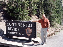 | ||
| On the Divide. | ||
 | ||
| Columbia River, WA. | ||
Actually, I did not yet explain why this story bears the title Across the Divide. There is a virtual
line (a curve, rather) drawn across each continent -- it runs along highest mountain ranges and highlands, and
all water on one side flows to one ocean, while all water on the other side of the divide ends in a completely
different one. There is even a triple divide in Czech Rep., for Northern, Baltic and Black Seas. Here in America,
the divide runs through the Rockies, therefore also through Yellowstone and Glacier Parks. Highways wind through
valleys, divide jumps from one summit to another. Passing the passes, I found myself every so often on one and
again on another side. The picture was taken in Yellowstone, in a spot where a creek cannot decide and frequently
switches between Atlantic (it becomes Mississippi on the way) and Pacific (turning into Snake or Columbia River).
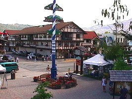 | ||
| Willkommen in Leavenworth, WA. | ||
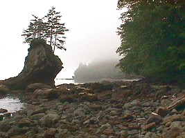 | ||
| Hazy coast of Olympic Peninsula, WA. | ||
Having negotiated a substantial part of Washington on highway 90, including one night at a motel, I found
but one remarkable spot here - the Columbia River, a picturesque canyon in a middle of otherwise boring plain.
It was Sunday afternoon and as I approached Seattle, traffic got noticeably thicker.
I pictured three neverending lanes of weekend homecomers, bumper to bumper, stop and go in average walking pace,
and I got sick immediately -- next ramp, I turned out for the forest. Thus I returned to the scenic highway 2,
meandering through national forests and mountains with Indian names. In the midst of it all, there is a small
town named Leavenworth, and I did not believe my eyes. As if I suddenly teleported to Bavarian Alp foothills.
German signs everywhere, German country style architecture, Lederhosen. I bought a tee-shirt with a funny
printed sign on. The sales clerk gave up pronouncing my name off the credit card after several attempts (I have
got Zdenek there) and to my question, she said: "Do you really think Leavenworth is a German village?
Oh no. This all is just a gig for the tourists!" But I must add, they are pretty good at it.
 | ||
| Rainforest on Washington coast. | ||
 | ||
| Path to Flattery Point. | ||
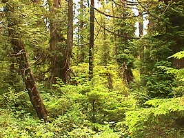
Even though I got closer to Seattle after eight p.m., the traffic was still heavy and I had no urge at all meeting the city. I opted for an escape route to Olympic Peninsula, the westernmost point of continuous United States (you ought to leave out Alaska and Hawaii), promising a good chance to camp at a national forest. To find it proved to be somewhat harder than I had expected, especially at 2 a.m., but in the morning I was rewarded by hazy, mysterious scenery of a rain forest emerging from a veil of vapor and meeting the placid ocean. Such things are damned difficult to photograph, since it usually results in a smudge of various shades of gray.
Washington coast sports an original rain forest growth, which is harvested intensively in many spots,
with a jolly support of the Indians who reserve small areas as reservations -- even there, heavy trucks keep
on moving giant logs. Perhaps only inside the Olympic National Park, they leave virgin woods, while the rest
of the land gets industrially reforested; around the highway, proud signs announce tight schedule of deforestation
plans and wonderful successes of business-motivated transformation of the landscape.
 | ||
| Cliffs of Flattery Point, WA. | ||
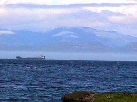 | ||
| Vancouver Island, British Columbia, across San Juan de Fuca Strait. | ||
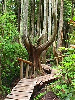
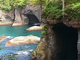
The most remote five square miles of the peninsula, Flattery Point, is also a reservation for Indian Makah tribe. Paved road ends here and I got lost momentarily in a mesh of identical forest roads; it was necessary to use GPS. One has to walk the last mile, which is very good. Nicely kept trail took me across the rain forest to a magnificent vista at the Tatoosh Isle, and cliffs full of caves and arches like Swiss cheese.
I met interesting people from Seattle here, Marilyn and Cliff; it was my first coherent communication after
a week, since Little Belt Mountains. Cliff is a walking encyclopedia, he immediately recognized a bald eagle
circling above us, and kept talking about the local biotope. I told them about my trip and such; their faces
revealed a few hints that they probably just joined the ever growing collective of people
who are convinced I am crazy.
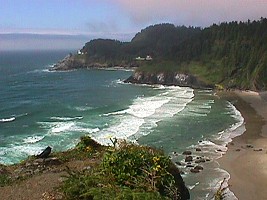 | ||
| Oregon coast. | ||
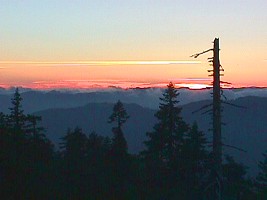 | ||
| Sunset in the Rogue River Wilderness. | ||
My journey continued south, along the coast, on the infamous highway 101; first through Washington state, then, after a rather bad night at an overpriced motel in a resort town of Seaside, OR, I kept swallowing Oregon miles. The odometer rolled over 4000 miles and my overall saturation with the trip reached me fully and vigorously. After having tasted driver's paradise - Montana - the omnipresent oregonian 50 mph seemed extremely prudish. Worse, Oregon drivers don't know how to drive and cannot handle situations involving more than two vehicles. Such boneheadedness has naturally risen to local law, hence you have to slow down to 25 mph in every little hole, even on a thoroughfare, so that you could not cause Sunday drivers to need to change their underwear.
Plus the weather did not play along -- well, relatively to Wyoming and Montana. It is quite possible that
fog and strong, chilly wind is the best what oregonian July can offer. You may be now under the impression
I don't like Oregon -- quite the opposite, even my most favorite National Forest lays here, the Rogue River
Wilderness. That highland was my destination for the day and I reached it by dusk. No joy. A paved road connecting
Gold Beach with Grants Pass, one and only access route, was closed for landslide. Fortunately, there are
always some dirt roads around, and what is that for my wagon after oh so much happy unpaved raging in Montana!
So I climbed a hill, turned off the engine, and listened to the silence of a country devoid of man. I laid
down to my last forest sleep.
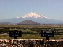 | ||
| Mount Shasta, CA. | ||
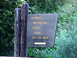 | ||
| A still life with a sign. | ||
I had hoped I would find places in the mountains of southern Oregon where I could pick mushrooms.
But the forest appeared quite dry and it grew unpleasantly hot by noon. What a difference from forever
moist mushroom woods of Glacier National Forest. Naturally, I can't travel 2000 miles for mushrooms;
I would have to wait till they start growing again in our Santa Cruz Mountains, that is till December.
In Grants Pass, OR, I joined the express Interstate 5, which occasionally allows for an unbelievable speed limit
of 60 mph in Oregon -- how ridiculous. Dusty and dry Cascade Range passes expected me, a view to the icy
Mount Shasta, our little Fuji, and then just taxing heat of Sacramento Valley. Radio announced 95°F and
I realized I was back in summertime California.
The total mileage of this trip amounted 4218, spread over twelve days.
My travel took me through California, Nevada, Idaho, Wyoming,
Montana, Washington and Oregon. The easternmost stretch was in Yellowstone N.P., WY, northernmost turn was in Glacier
N.P., MT, westernmost point was at Olympic N.P., WA. This story plus pictures took me three days to process, i.e.
the rest of my vacation. English version took another (already working) week.
Faithfully Yours, Hippo.