
 |
FEBRUARY ROUND | |
| Hippo's weekend: Valentine + President's Days at Sierra Nevada |
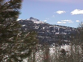 | ||
| Promise of the mountain sky. | ||
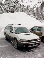 | ||
| My lodging at Lake Meadows. | ||
It's been raining for over a month here in California. I say rain and I mean that for example my friend
Mark's two cars
were flooded (one totaled) and water took his house insulation and killed his heating oven. Homes fall down
the coastal cliffs and slide into canyons. Every night, when I park my car in our underground garage, I have
such a nervous feeling.
There's much joy in the mountains, over six feet snow in places. I decided to flee the drainpipes to see the
joy with my own eyes. I have seen winter desert in Arizona; wondered what winter California's mountain lakes
look like.
Departing via Interstate 680 and later 80 from San Francisco Bay over Sacramento to Reno, Nevada, I dined a
peculiar though tasty Chinese meal at a cowboy-style saloon in the historical mining town of Auburn.
Dusk caught up with me in the foothills of the Sierra, and I caught up with a stall -- Caltrans decided to inspect
each and every car, mainly because of fools like me. I don't carry snow chains, you know.
However, I was pleasantly surprised: since my car is an AWD (all wheel drive, that is), just as if I had my chains
I passed and drove on. Still the wait for the inspection took about 3 hours, revving up the engine, stepping on the
clutch and jumping a few yards every once a while, only to watch the uphill line get stuck again. All that in
a steady rain mixed with snow, complemented by slush sprays from other cars.
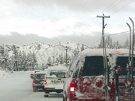 | ||
| Congestion at Squaw Valley. | ||
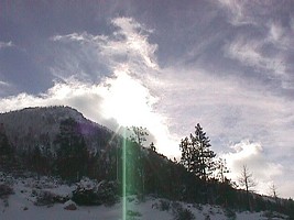 | ||
| After a month of rain - sunshine! | ||
So I drove on, sometimes faster than those rattling, chained vehicles, whose drivers paled upon facing spots of clean and hard blacktop; I reached the Olympic Center around ten, with my whole mind focused on bed, now. Having tried yet another gadget of my wagon (ABS - non-blocking brakes) on a treacherous icy road, and having dashed through snow piles on a giant, empty parking lot, I went to sleep.
But I was not to slumber for long. It was freezing outside and the snow was falling and I woke up already
at 2 a.m. to the roar of a Diesel engine, the rumble of chains, the swish of a plough, and the annoying
beep beep beep beep - when the bulldozer was backing up. Before I could make sense of it, the fellow contoured
me like a barber misses your ear with his blade -- he really knew his job, there were just two inches of snow
next to my mirrors and bumpers. I stuck my head and arms out of a window in a desperate gesture.
Having stopped his engine, the plough man grinned and told me to go back to sleep. Eventually he recommended
moving my car down into a cleaned area, so I did and I dozed off again. For the rest of the night, it was snowing
just a little.
 | ||
| Lake Tahoe. | ||
 | ||
| TRANQUILITY Illustrated | ||
Awoken by buzzing skiers, I rushed into Squaw Valley to report on the announced mountain joy. My own impatience betrayed me, though. A congestion of snow-eager motorists was so bad, so unmoving, and so promising hours of stick-shift and clutch dance, that I gave up and turned around. Maybe I did the right thing. Skiers everywhere, I came unprepared, sadly watching those snow-covered signs to hiking trails, now hopelessly hidden.
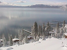
The California/Nevada border cuts through the iceless Lake Tahoe. It is cold, clean
and sufficiently deep to attract scuba-divers in summertime. The whole area is a favorite trip destination,
with a high concentration of snow sports in winter and water sports in summer, as well as casinos on the Nevada
side year-round. San Francisco Bay and both capitals of CA and NV come here to relax; accommodation
and food is accordingly priced and available. Yet Hippo is not afraid of that, he brings his own home (my wagon, my
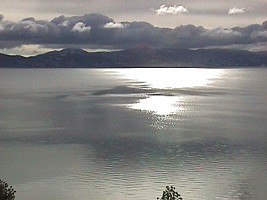
home) and food. The surrounding mountains and forests render the lake strikingly beautiful, its placid surface
reflecting
majesty and tranquility. I managed to find a cleared uphill road to some cabins, hence my hike in a frosty,
sunny air allowed for a few snapshots.
 | ||
| On the road to Carson Valley. | ||
 | ||
| Carson Valley - at 60 mph | ||
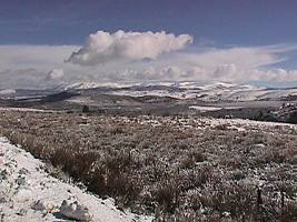
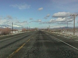
It was not so easy to get out of the Tahoe area. First, I had to girdle it on the Nevada side, which is less pretty in my opinion than the California road, with its famous Emerald Bay and waterfalls. They were closed for avalanches this time, so I had to read hundreds of casino billboards and signs instead. I found the Monitor Pass closed eventually, leaving only road 88 open to reach my desired highway 395. I had to go back to the Carson Valley, but I did not regret it. More and more ridges and white plains opened before me, a landscape I remembered deserted and rocky in the summer.
The Sierra Nevada mountain range reaches skyward between California and Nevada. Its paramounts average easily
two miles. I have climbed one of them, Mt. Sonora (11,495 ft), in the summer (from the Pass at 9,600 ft).
The climatic change is drastic. While the western wooded slopes drop to the San Joaquim and Sacramento valleys
near the sea level; Nevada's high plains sometimes look like valleys, though they have 3,000 feet of elevation,
featuring deserts and rocks. The little layer of snow you can see on the pictures may be the only water for the
rest of the year.
 | ||
| GPS - traveller's helper. Yellow receiver behind a windshield above, notebook on a car seat below. | ||
 | ||
| Conway Summit - a freezing Hippo | ||
The next thing I did was getting lost. I had the overall idea how to get to the highway 395, but following the road 88 and turning sharp right seemed so inefficient. I opted for a shortcut. Soon I found myself entangled in a mesh of identical roads, wildly winding through same fields and among look-alike buildings. Slowly chewing cows watched me emphatically, the locals watched my driving up and down their roads with just a shade less enthusiasm. Long western sky stretched to the distant horizon and even the sign beyond the next ditch did not say "To 395". It said "Trucks not advised".
Naturally, I had obtained a map before going. USA Atlas 1998, $9.95 at Costco Wholesale. The Lake Tahoe is shown about as large as a penny, with other details of western Nevada to match. My desired 395 leads through the valley, the road I was on did not. But Hippo does not drop his spirit that easy. I pulled out a small bag and started connecting the cables, satellite receiver, battery voltage converter, my employer's notebook and appropriate CD-ROM, all together forming an unfailing and functional helper for the misguided pilgrim of the late 20th century. The GPS (Global Positioning System) is a miracle, it found itself in Nevada within a minute, on some meaningless road in a settlement five blocks away from the wanted highway, accurate within 100 feet.
Miles went by quickly on the Highway 395. One by one, I passed my favorite turn-offs to Sierra passes, each closed
and impenetrable. The only cleared road led north to Carson City and Reno, and south through Bishop and Mojave Desert.
I followed the sun, but every time I stepped outside my car I got all the chills and shivers. See for
yourself.
 | ||
| Lake Mono, a flat crater drying out for centuries. The dark line in lower right corner is a four-lane highway. | ||
It would be a mistake to approach Lake Mono from south, you would deprive yourself of a dramatic experience. Coming from north, the road winds through mountain slopes, then suddenly twists left and the whole basin opens before you, who is watching if from a quarter-mile cliff. Mono in summer is even more breathtaking than on the picture above, because hills would keep the snow, while the blue lake contrasts with the sand-brown background and a black cindercone in the middle.
They say the basin was a volcano that had exploded and only a small fried hill remained in the middle of the lake.
The area is still volcanically active, underground supply of sulfur breathes out and water in the lake is
saturated with minerals. Not potable, as you can expect. A strange kind of fly lives here. They would sit on you,
but they do not sniff or bite you, as they eat minerals directly from the water -- don't ask me how.
Now in winter, there are no flies, nor tourists, whom I seem to recall along somehow.
 | ||
| Winter Desert. | ||
 | ||
| Turn Right to Death Valley | ||
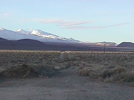
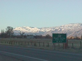
Although it did not get any less cold, snow seemed to thaw right before my eyes, on my way south and toward Bishop town. That is because the terrain drops in altitude, you drive down from 7,000 to some 2,000 feet above sea level. There I was finally surrounded by the good old desert, which looks the same in winter as in summer. Looking closer, it differs a lot, though. Every ditch, every mound is full of water or at least mud, and the thorny bushes that seem to fill the desert blossom up in their own, brownish and gray manner.
Having sensed an urge to swallow something traditional (and since the combination of apple, kit-kat, raw green cabbage, and cold coffee milk cocktail got marginally boring), I rejoiced when I saw a roadside "Mountain View BBQ". I ordered a brisket platter and spicy beans, pissed off the owner by sending the waiter away with a brisket sandwich and a Cole slew (what was he listening with?), eventually ate my original order with a lot of appetite, washing it down with a Coors Lite.
I decided not to enter deeper into the desert. I would have risked so called flash flood, when suddenly
starts to rain and the least uneventful dry creek becomes a roaring river stream for a few minutes. It devours
a car like a berry. To walk the desert or to drive on dirt roads in winter is not clever either, since the dust
has been turned into mud, and as much the car was already discolored beyond recognition, I did not relish
the idea of an internal muddy layer I would inevitably create. Hence I passed the turn-off to Death Valley
and drove on into the Mojave Desert.
 | ||
| Sierra Nevada - never ending white slopes. | ||
 | ||
| My wagon - Subaru Outback | ||
Sunset found me on the southernmost turn of my round, a few miles away from California City. A shortcut No. 14 connects Highway 395 with the 58, which cuts through some serious hills, dwarfed southern tail of the Sierra. I fed gas to my wagon in a town with a picturesque (no doubt native) name Tehachapi. First settlers came through this pass from Nevada to California and discovered the fertile San Joaquim Valley. Through Bakersfield I reached Interstate 5, and followed it home, mere 250 miles to go.
I have planned to return with a shiny wagon -- too bad. One cannot depend even on a long-lasting rain. Despite of all forecasts, the rain stopped all over Central California and there was nothing to wash away the mud, the salty layers from mountain roads, the desert dust. I therefore finish my report with a couple of snapshots from the "cleaner" part of my journey.
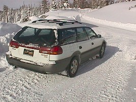
The whole voyage, including sleep, short hikes, and taking pictures, took me 32 hours. I drove a little over 900 miles. The wagon is my new Subaru Legacy Outback AWD 2.5 liter, pictures taken by digital Sony Mavica MVC-FD7. It took about 4 hours to write this report.
Yours Sincerely,
Hippo.