 |
| November 3 - 5, 2000 |
| |
| |
 |
|
| Mono Lake |
| |
| |
 |
|
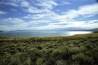
| Mono is able to look like a completely normal lake |
We were determined to drive out for the weekend, on a "serious" trip. Since
I came to the U.S. we did not get out much, only for a day or an afternoon. So we wanted to enjoy it again,
and we decided to go to Mono Lake. The said is located on the other side of Sierra Nevada, beyond
Yosemite National Park. Mono Lake is kind of American "Dead Sea", only not even closely as dead
as it would seem. Though it has no outlet, therefore is 2.5x more salty and about 160x more alcalic than an
ocean, there are flies that live there who feed on the water. In their gastric tract they harbor bacteria
that break down minerals and subsequently get digested by the fly. The fly then gets eaten by a duck
or an Indian and so forth. The name of the lake comes from the word Monachi, which means "fly people" in
the language of Yokuts, who called so their neighbors, one of Shoshoenan tribes. Shoshons used to live at the
lake and eat pupae of the mineral-eating flies.
| |
| |
 |
|
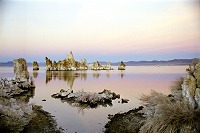
| Tufa at sunset |
| |
| |
 |
|
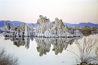
| minerals coat everything... |
Mono lake has formed inside a collapsed volcanic crater, so it still gets bubbled through
by various springs and hot gases, saturated with minerals. They are the source for so-called tufa.
Tufa grows as mineral sediments surround a spring, until they form a column, which reminds of a limestone stalagmite.
Rivers flow into Mono lake, but Los Angeles tapped five of them for water, since it is built practically in a desert.
That lowered the water level in Mono dramatically (by about 50 feet) and tufa became visible above. (Un)fortunately,
Los Angeles was forced to stop taking so much water and so since 1994 Mono lake grows again. Which means that if
you want to see the tufa, you only have a few years left until it all disappears under the surface.
We wanted to go to Mono lake through Yosemite, but it said on internet that Tioga Pass was closed,
so we headed to Sonora (i.e. to north-east) instead, where we planned to overnight and then on Saturday cross Sonora
Pass to Mono (to south-east).
| |
| |
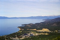 |
|
| Tahoe - view towards Nevada side with casinos |
| |
| |
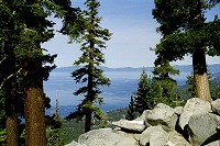 |
|
| Tahoe from Heavenly |
When we finally got off a freeway, a big sign said Sonora Pass CLOSED.
We decided to make a wider detour further north, overnighting at Tahoe. I remember Tahoe
with mixed emotions, because that's where we ran into a bear in summer, but I concluded that
every well-behaved bear would be fast asleep in his bed in November, and would not roam the woods.
Lake Tahoe is located on California - Nevada border, which is probably the only
interstate border that I ever got to notice. Besides a "local folklore" in the form of
grocery check points on the way home (one may not import agricultural products to California)
there is one more advantage -- after skiing you can run over to Nevada and spend a wild night at
a casino (Nevada practically thrives on gambling and supports it by low taxes).
Nothing against gambling, but an architect who erected skyscraper-bound casinos and hotels at Tahoe
should immediately turn in his diploma.
| |
| |
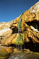 |
|
| though there's not faucet on the hot water ... your bath is ready |
| |
| |
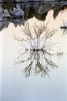 |
|
| Monoflake |
On our way to Tahoe we gained some 7000 feet elevation, snow was everywhere and the moon
shone on it all, simply beautiful. Even with our tent and mattresses and sleeping bags we brought along,
it was still too cold outside, even just by looking out of the car window, so we thankfully landed in a motel at Tahoe.
In the morning, a cabin tram took us up half way on a slope called Heavenly. Ski lifts and
snow sports continue uphill, but this time they were still dysfunctional, as it had snowed only last weekend and not since,
so there wasn't that much snow around. For a while we hiked around a few hills (wonderful winter weather - snow,
warm and sunshine).
From Tahoe, we eventually headed for Mono. On our way we stopped at
hot springs. This is a great device, where you arrive, take off furs and shirts, and when you're naked,
you drop into cozy warm water, pines above you, snow-tipped mountains on the horizon... there is one natural
pool for two or so on top of a slope and then more hot streams flow into a creek. It's a lot of fun, because
you sit on one side of a mountain creek, sploshing merrilly, and icicles drip on the other side. The only negative
part of the whole affair is that you sooner or later MUST get out of the water. These sprigs have one more plus
- they are natural and unofficial, so you can skinny-dip.
| |
| |
 |
|
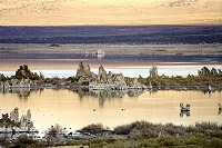
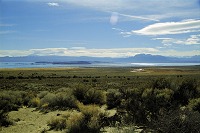
| Mono - puddles in foreground are hot spring ponds |
| |
| |
 |
|
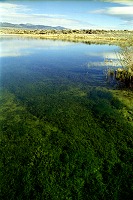
| Looking into the pond |
At last, we emerged with a wonderful feeling of cleanliness -- minerals must have some effect
on your skin, for you feel quite different than after a tub bath. We wanted to reach Mono Lake before sunset to still
get to see it. Being one day late compared to our original plan -- closed passes meant substantial detour (just like
going from Prague to Vienna over Warsaw). Still our timing has worked out and we managed an evening walk among tufa.
Tufa rocks are up to thirty feet high (says printed guide) and in one spot form a real maze. I felt a little like inside
a limestone cave, but without my usual claustrophobia. The Lake was bubbling and burping, ducks sploshed around.
I could not resist and tasted the water to check out whether it was really awfully salty. It was.
As the night descended, we found our place at a motel for the night, name was Murphy's (I think)
and I can only recommend it (it was extremely clean). The owner told us that Tioga Pass got opened at noon.
And we rejoiced that we were able to take a direct way home, through Yosemite, that is.
| |
| |
 |
|
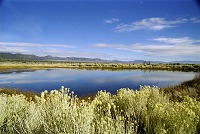
| Hot spring pond |
| |
| |
 |
|
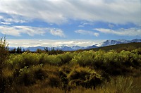
| Our desert |
In the morning, we went to see pools that contain hot springs. These little ponds
do not freeze over in winter and they are allegedly full of ducks. Originally they were part of the Mono Lake,
but as the surface descended, the pools separated and finally people made dykes around them. I though they would be
warm just like the hot spring up the road, but I was disappointed. No dipping in that! Neither ducks were abound,
perhaps it was too early for them.
We still wanted to circle the lake on some dirt road, but we got lost in middle of nowhere. Desert means
bushes and little trees, just tall enough to prevent you to see from the car where you're going. Now add youngsters who
ocassionally speed through in their jeeps, creating new roads, and you get a perfect maze. Roads are tracks in sand among bushes.
Volcanic dust and sand are fine and light - grains contain air bubbles, an ideal material to get your car stuck.
As our wagon is not really an all-terrain vehicle, and since we forgot our GPS CD at home, we started to wander through the desert
rather aimlessly. We gave up and returned to the highway. Anyway, it was time to go to
 .
.
Text & Photography Copyright © 2000 by Carol & Sid Paral.
All rights reserved.


![]() .
.