Desert(ed)
24.- 26.11.2000
We planned to leave early morning on Friday after Thanksgiving (holiday),
but since party at Kren's had been pretty demanding, the following morning went a bit out of control,
so we were leaving at our usual 3 p.m. (well by that time we had been packed, our Wagon had its oil changed
and we ourselves had had lunch at Tien Fu).
We pushed across Pacheco Pass and through Central Valley to Tehachapi Pass, where we wolfed down
sandwiches at "historical" bar (yes, it has been probably there for whole seventy years!).
They had there an interesting photograph exhibition. Main room walls were covered with
planes, jet fighters/bombers, and space shuttles (Mojave is far from being thrilling, though
some spots could be hyper-exciting if you were only allowed to see them. Army has isolated them
from common beings by miles and miles of pretty deserted ... uh, desert). In the next room
there were pictures of famous Tehachapi [railway] Loop. They found when building tracks there that
an engine would not drag a train up such a steep hill, so instead of tunneling through the
mountain, they made the train to go around a 360° circle, gaining altitude gradually.
We got bed in Ridgecrest, at a motel maintained by an Indian
(non-Native-American) family.
Included were beautifully colorful tiles in the bathroom and a strip with
oriental patterns around all the walls just beneath the ceiling (not mentioning
a wonderful picture of mountains, lacking only rutting deer to achieve perfection  ).
I have never been in a cheap brothel, but if there is one, it must look like our room there.
Unfortunately we also had hot air heating with incredibly noisy fan.
We decided rather to freeze, but not so our neighbor.
It felt like sleeping closely to one of the army bases nearby,
with fighter jets constantly taking off just behind our heads.
We went out unusually early next day
(before nine  ), so the only
open shop where they would pour me my starter coffee was Carl's Jr. (something similar to McDonalds),
but a friendly service and a hot mug took precedence over my usually holy principles.
| |
|
|
 |
|
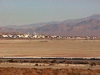
| Welcome to Trona... |
We started for the desert. Mojave is a first real desert I have ever come to.
Empty, great and beautiful. But it welcomed me with a horrible stench. Just when I started blaming
the atmosphere in the car on somebody's bad digestion, we drove over a hill and saw the smoke pillars. Trona.
Trona consists of huge constructions of
tubes, girders, ladders and handlers, crowned by smoking chimneys and
sulfur stink: a nightmarish salt factory. And around the mill, deteriorating cabins and motor homes
are seeded, accompanied by a corresponding number of car skeletons. And sand and salt and dust everywhere.
In Mojave, one probably does not have many choices. Either something connected
with army, or work in mines - or welfare. In some parts, choice might be enriched by
tourism, but not much. Simply desert.
| |
|
|
 |
|
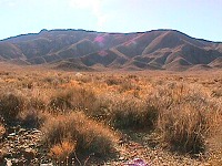
| Hills in terry cloth |
But not to describe Trona as so desperate - on the windward side of the town,
there is a residential area with reasonably good looking houses and a
freshly painted school. But behind this, there are several miles of car junkyards.
I can still recommend Trona for you to see, it is an interesting place, you will realize how
well off you are.
From Trona up to the Death Valley entrance,
no civilization happens. We stopped on a hill with overview to
Panamint Valley (that is the valley before Death Valley)
and there the desert breathed into my face for the first time.
Nobody anywhere, no house, no fence, thick silence. And only hills around,
without a single tree. There is suddenly nowhere to hide and one is looking backwards
to see where woods disappeared.
I got used to it in a while, there is always something to look at
in the desert. Mojave hills are colorful, covered with bushes. That gives
them the look of being smartly dressed in a dark brown terry cloth (at our place,
with grass, they look like if they grew fur).
| |
|
|
 |
|
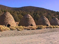
| Charcoal Kilns in Wildrose Canyon |
We braved through Wildrose Canyon road, which is neither wide nor well maintained
(as there is also a decent road to Death Valley). Wildrose Canyon
curves right under Telescope Peak (11 049 ft) and goes through
a tree line. Sid stopped near very strange stone buildings, which looked like
grand bee hives. I was supposed to guess what they were for, but my imagination
could not handle such task. They were charcoal kilns.
| |
|
|
 |
|
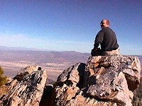
| Aguereberry Point overlooking Death Valley |
Because Sid has never been on the Telescope Peak,
we wanted to correct it this time.
Road up there is really rough and ends in a campground, quite a bit beneath the summit.
At this altitude, there are trees that look normal, some kind of pines. It is too
hot for them lower and too cold higher. We would have to walk another seven
miles to get to the summit which would mean a whole day trip, so we postponed it for
next time, our main goal being Death Valley.
After crossing the Emigrant Pass (yes, that is its real name,
which seemed to us quite fitting),
we fell to temptation of a reasonably good looking dirt road. After some two miles, we found
a ghost mine. But the road continued into a canyon between hills on the horizon, so we went there.
When we just started to consider using our GPS to see where we were actually headed, a
port-a-potty appeared in front of us. Yup, tourists had been expected here! Rightfully so - a wonderful
view to Death Valley opened before us. Apparently only because of bad road, Aguereberry Point (6433 ft)
remains undiscovered (thanks God) by tourist crowds. Those two Japanese guys who hung around left as we came.
| |
|
|
 |
|
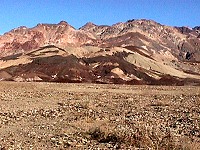
| Death Valley - isn't it beautiful? |
We sat on a rock and stared down, fascinated.
The view was amazingly colorful... and the silence around deafening. A complete silence. Not even a bird.
My attention was caught by thick grey line through valley,
so I cleverly asked whether that was the road we were going to take.
Sid looked at me somehow strangely and said: "you got the scales confused" So I had.
There is little air humidity in the desert and visibility then extends to hundreds of miles. That "road"
of mine was a large, dried up, salt river bed. Real roads where not visible at such distance (Sid claims he
saw them but he knew where to look), and a town was that little green spot on the other side of the valley.
| |
|
|
 |
|
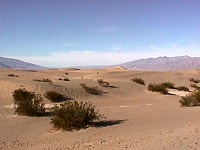
| Sand dunes in Death Valley |
For me, the name Death Valley always meant hopeless heaps of sand, where nobody goes because
of dreadful heat. Well, it IS hot there. Now, in November, it was not too bad, it could be some 25 degrees
(80° Fahrenheit), but in July it goes over 45° (110° F). The valley has 13 760 square kilometers,
with its highest spot being Telescope Peak (11 049 ft), and the lowest being Badwater (-282 ft).
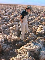
There are lots of interesting places in the Valley. Sand dunes at Stovepipe Wells Village, the Devil's Golf
Course at Badwater. The story goes that a golf player was claiming to play well so devil took him to his
golf course. The court looks like ploughed field, only the soil is hard - it is made of salt stacks. Hard
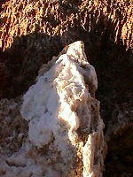
and sharp, not recommended to trip and fall there. At some places a stack can be broken and than you can
see the white hollow inside with crystals.
| | | |
 |
|
 |
| Devil's Golf Course |
|
A crystal at the Course |
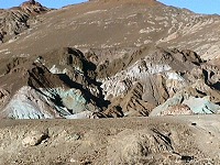
Sid promised me Artist Palette, which was packed with tourists, but to see a place with
lot of small, differently colored rocks, is worth the trouble.
As the stone includes different minerals, there are red, yellow, white, black, blue,
green or violet rocks. A bit like in an opium dream. We did not manage then to be on time for
sunset on Zabriskie Point, but my eyes were popping out with weariness anyway. They were unpleasantly
burning, probably from the combination of sun and dust. Fortunately we carry with us
eye drops for Sid's lenses, so I could water my eyeballs a bit.
| |
|
|
 |
|
| Artist Palette |
Our next move decision fell on Joshua Tree National Monument. It was quite far,
but after a sunset at five there seemed to be plenty of time to drive through boring places to somewhere nice.
So we took off. Sid started our GPS and I was driving like a racing car driver.
Not so fast, only Sid was predicting upcoming turns. Army is putting some error into GPS measurements, but even
with it, GPS can get your position with few feet accuracy. We carry a laptop with maps,
so at night instead of messing with paper maps the size of a clipper sail, and a flashlight,
we stare onto the screen. We were playing with it the whole way to 29 Palms, and would not guess
how much this practice will come handy later.
29 Palms (that's its real name!) is a small town at Joshua Tree NM borders, and
seems surviving only because of existence of big marine base nearby. Yes, you read correctly.
In the middle of the desert, there IS a marine base.
| |
|
|
 |
|
| Joshua Tree NM |
| |
|
|
 |
|
| Rocks at Joshua Tree NM |
We got lodging in a motel (for a change) with an Indian owner.
I am getting to suspect that all Indians buy equipment at one wholesale store.
We did not get the same artistic piece over our bed this time,
though we were honored with same tiles in the bathroom, and the ubiquitous noisy heating.
On the top of this, the shower was perfected by a dark purple curtain with red pompons!
We immersed into city rush to swallow some dinner.
Our fight over choice of cuisine (shall we get Japanese, Indian or Mexican?)
was unnecessary. In the whole town, only one pizzeria was open,
beside a video rental, McDonald's, tattoo parlor and TWO barbers promising
"real marine cut".
Out of despair we drove toward the base, wondering if the army could have some
dining facility. It did not, but the surroundings were getting more and more "marinated",
so we returned to the not quite promising pizzeria. We washed the dust in our throats
down with a jug of deer slop. American beers are drinkable only when you had just returned dried out from a
desert so you would not mind the color of a lemonade and taste of... well, a deer slop.
| |
|
|
 |
|
| Yucca |
| |
|
|
 |
|
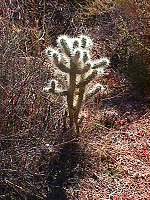
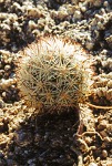
| Cute Furry Cactus |
We were not looking forward to breakfast with much hope, prepared to bear with
coffee and sandwich at a local grocery store. But the shop was so awful that we left and found -
a Finicky Coyote in front of us. It is a little cafe, crossed with a sweets shop and a gift shop -
again one place with character, friendly service and wonderful food.
So we were taking off for Joshua Tree NM almost euphorically.
Sid pointed out to me that to the left side of the road was an Indian reservation.
Well - it looked the same as everywhere else. Houses, cars, tidy
cactus gardens (I do not mean it ironically, common flowers do not grow there and cactuses are real
beauties).
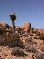
Joshua Tree got its name from a special kind of yucca,
which grows here. Yucca branches are grow out of trunk in bizarre angles,
so they look like a man with outstretched arms. Mormons saw in
trees a resemblance with biblical Joshua, so they named them Joshua Trees.
| | | |
 |
|
 |
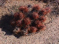
| A Cute Red Cactus... |
|
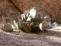
... and a Cute Green Cactus |
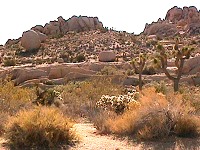
Joshua Tree NM is a very pleasant place.
Yuccas are welcoming you with open paws, everywhere loads of cute cactuses, which politely grow polite apart just to
allow a human being walk among them. But I recommend higher walking boots and jeans - if YOU do not keep the polite distance,
you end up being a huge pincushion. And not only that - to the amusement of other visitors,
you will have to drop your pants and pull all the needles out of your skin - most of cute cactuses have pins the
size of a bigger needle, though much much sharper.
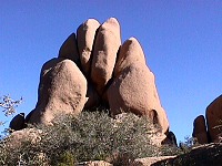
Apart from yuccas and cactuses, there are beautiful rocks at Joshua Tree NM.
My clever book says they are of monozoit, which looks like roughly structured granite.
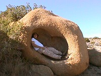
Monozoit is eroded into amazing shapes, you feel like at exhibition
"Dali and his croissant phase". In this park nobody would hassle you with "STAY ON TRAIL" signs, but
be careful - croissant shaped rocks and cactuses look all the same and it takes only seconds to get lost.
| | | |
 |
|
 |
|
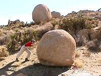 |
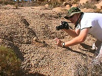
| Sid taking picture... |
|
...of a ball... |
|
... and all the hard work was left to me :-) |
So we roamed through the park, showed each other the cutest cactuses, pulled needles from
our thighs, climbed rocks and felt like in a garden.
But it was Sunday and we had to get back home. We quickly drove to Keys View, from where you can
overlook Palm Springs, lake Salton Sea, and - with some luck - see all the way to Mexico. We had the luck.
In Barstow, we stopped for lunch at Golden Dragon. The pub did not look very tempting from outside,
but they serve well prepared, tasty Asian dishes - which is rare to find further away from the coast here. During our late
lunch we heard on radio that the highway fifteen was blocked and would stay blocked for another hour or so
because of a car accident. We did not care much as we did not plan to take 15 anyway. We paid the waiter
who claimed remembering Sid from last time (this was the third time in 5 years that Sid ate there) and
we happily went off on highway 58. Just few miles outside Barstow it suddenly looked like fire in the desert. And
then came the stoplights and we stopped. We did not know what was going on because the fire area seemed
far away. Little by little, we were moving slowly forward and despaired over maps. We were trapped, no
way out of the blocked 58 unless we would divert through 100 miles of detours. When we got closer, we saw that
it was not smoke but dust churned by cars that crossed the freeway median and opposite lanes to drive on
a dirt road parallel with the highway. The traffic was stopped as far as we could see so it was not
hard to choose to go on the dirt road instead of waiting for hours in a hopeless jam.
| | | |
 |
|
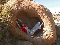 |
| At the exhibition "Dalí in his croissant phase"... |
|
... they have easy chairs... |
Sid tuned up the GPS, I switched on my fog lights and we were ready.
Some smartass knew about a service road through the desert,
which was built to maintain some tubes underground. Sid located us on the map, but he also found another dirt
road parallel with our current one. It seemed a better option, for it did not merge again with the 58 and
there would not be so much dust from cars ahead of us.
We found the other track but it was not in a good shape so we weren't terribly tempted.
We opted to look for yet another road, some four miles further.
It was possible to drive quite fast there, so I did. Bang!
In a fading daylight, just after sunset, the GPS did not warn us about another crossing with a well grooved track.
I could not see it, bushes up to the car roof were hiding everything and
yellow dust did not produce any shadows. The car dipped into the crossing ditch and out of it again.
Sid screamed because he banged his head, and was scrambling to hold the computer and the GPS,
and I believe I managed to utter several prayers, hoping to not having broken anything vitally important on the car.
The embarrassing idea of us walking several miles back to the highway and calling for help...
We were lucky, nothing broke and the road we thus literally hit, was well maintained.
And it led exactly where we wanted to go. It was another service dirt road, this time along electrical wires,
which were on our map.
I started to enjoy off-road driving, I began to wonder where I could rent a tank
 .
.
We arrived nicely just to the crossing of 58 with 395...
jammed the whole way back. And all that apparently only
because of traffic lights at this crossing!!!
We did not risk it to take it again and took
a detour, which was less comfortable and much longer, but without any traffic at all. Sid was describing
all the natural beauty around us, and he might have been right, around Isabella Lake and a bit through Sequoia
National Forest, but it was night already. Well, at least something left for next trip.
When the back roads took us finally to the highway five, we drove about a mile on it... guess what!!
Yes, a traffic jam again!! Sid pulled out our GPS and our computer and at the nearest possible exit, we went off and
rolled onto weird roads parallel to 5 and 101 freeways. The road led through middle of nowhere, which was
quite comforting. Around Paso Robles the traffic thickened a bit, but most of it was OK.
Then I started to have problems to keep the car on road
so the rest of our journey was up to Sid. We made over 600 miles just on Sunday,
through the whole weekend it was some 1400 miles. We got home at one a.m., totally worn out. But it was worth it.

 ).
I have never been in a cheap brothel, but if there is one, it must look like our room there.
Unfortunately we also had hot air heating with incredibly noisy fan.
We decided rather to freeze, but not so our neighbor.
It felt like sleeping closely to one of the army bases nearby,
with fighter jets constantly taking off just behind our heads.


